|
Merry Christmas to everyone – stay warmer than we did.  Pat and Daisy in Durango snow Sloppy Durango Downtown Durango was a sloppy mess of snow near freezing. We enjoyed slushing around with our dogs in our favorite city park, admiring the Strater Hotel and visiting our favorite French bakery, Jean-Pierre. But we had a decision to make – stay another night and risk slip ‘n’ slide driving to Pagosa Springs in tomorrow’s forecast cold, or go now, while it was a little warmer. We decided to go. 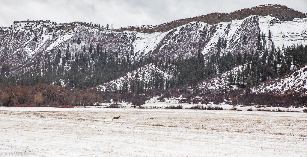 A buck in the meadow on the way to Pagosa Springs We drove past Chimney Rock, site of the furthest-north Chacoan Anasazi outlier, and made it through the snow to Pagosa. But it was so cold we bailed on the RV campground and found a cheap hotel. 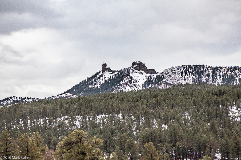 Chimney Rock near Pagosa Springs, Colorado Beating the Ice The rumored cold wave hadn’t arrived the next morning, but a major snowstorm had. We chose to move on once again, with the potentially dicey drive up Wolf Creek Pass. I coaxed my RV-driving California-native wife up and over in the storm. It was easier to negotiate than the worst snow I drove through in college – on I-57 between Chicago and Champaign, Illinois. But it was still tricky, and we breathed easier once we descended to South Fork, Colorado on the other side. 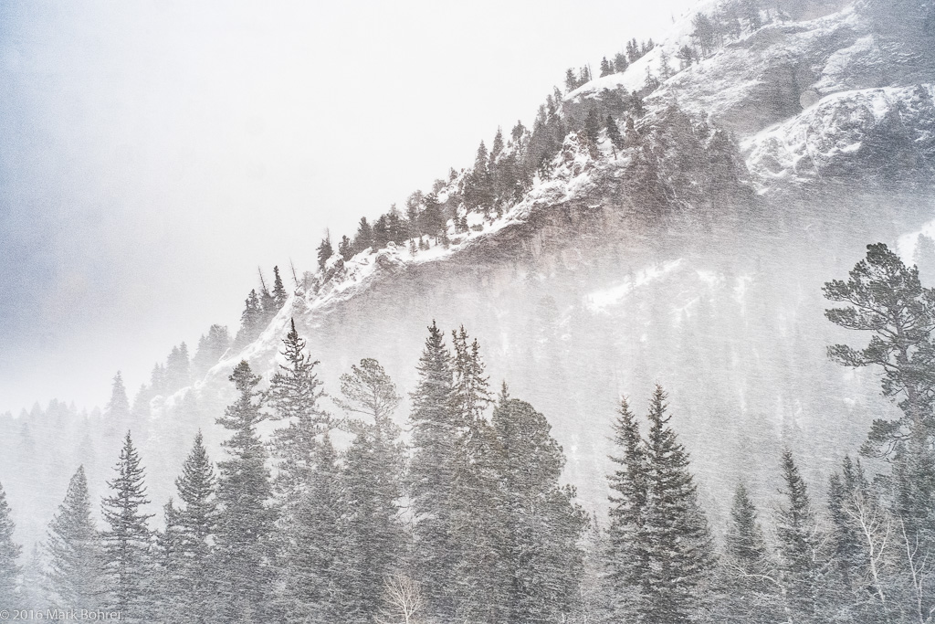 Near Wolf Creek Pass, Colorado We spent another night in a hotel in Alamosa – with a forecasted -7 degree low, we weren’t up for RV camping yet. On to Great Sand Dunes The storm was gone the next morning, but an arctic cold front had moved in behind it. At our first stop on the road to Great Sand Dunes National Park and Preserve, it was 7 degrees. We weren’t outside long. It was up to 21 degrees when we started walking the trail to the dunes – a heat wave. 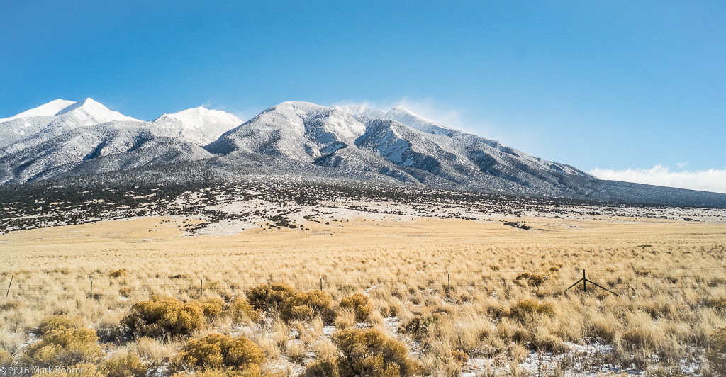 7 degree view of the Sangre de Cristos near Great Sand Dunes, Colorado The dunes collected over centuries at an inside ‘elbow’ of the Sangre de Cristo range, once under the water of Lake Alamosa. The lake formed in the San Luis Valley, bounded by the San Juans on the west and the Sangre de Cristos on the east. But water pressure broke through volcanic sediments at the south end, and the lake drained into the Rio Grande. 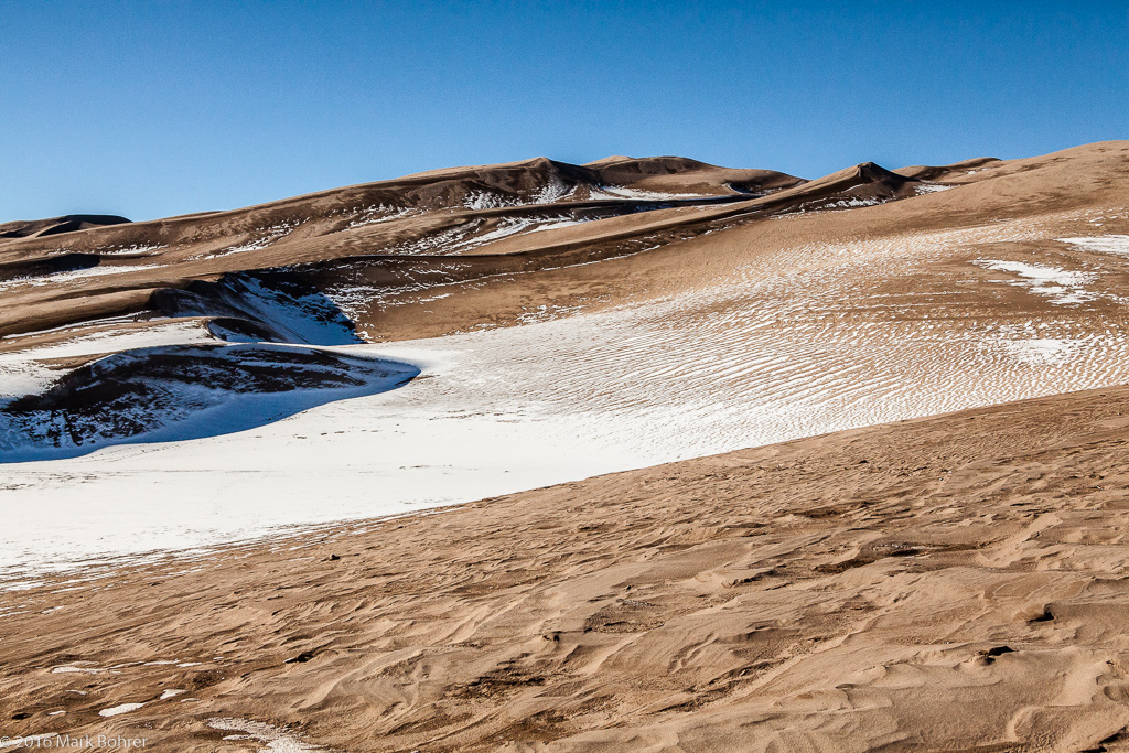 Dunes and texture, Great Sand Dunes National Park and Preserve Prevailing southwest winds blew leftover lake sand toward the ‘elbow’ in the Sangre de Cristos. But during storms, the winds tend to blow the other way, so the sand piles up, buffeted in both directions. And presto – you get great sand dunes. 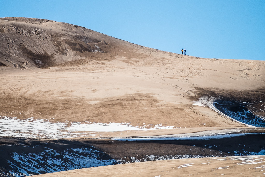 Near the summit, Great Sand Dunes National Park and Preserve We walked part-way over and into the dunes from the south. Our plan was to hike up the 750-foot high summit and enjoy the dunefield view. But we ran out of time. We made our way to the RV campground at Sand Dunes Swimming Pool near Hooper, Colorado around five o’clock. This hotspring-fed pool is open for swimming year-round – and it’s also the only campground near the Park that’s open in winter. I dodged a desert cottontail couple and photographed the blue-pink sky and mountains rising above the dunes. 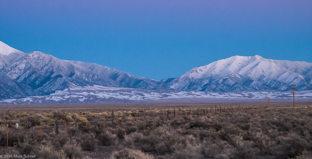 Dune field looks small next to the mountains – Great Sand Dunes Sand Dunes Swimming Pool is also the only place for food nearby. We ordered a surprisingly good pizza, and headed back to the RV to consume it. Warm in the RV? We usually use a ceramic-based electric heater to conserve propane at night in the RV. But this time, the cold was too much for it. We were a little frigid with inside temps just above freezing. The next morning, walking inside the RV in sock-shod feet got my toes numbly cold. I didn’t feel them again until I put boots on and stomped around outside for 30 minutes. There are ways to keep warm overnight in the cold. Most of them involve more heat than we used on this trip. When we got down to Taos, we figured out how to get the RV’s propane furnace blowing out warm air, so we didn’t have to rely on the electric heater. But it was also a bit warmer in Taos. Great Sand Dunes is a cool spot – literally at this time of year. The San Luis Valley is frequently colder than the surrounding area. It also boasts the highest dunes in North America. If you like photographing intense textures in low-angle light, this is your place.  Sangre de Cristos after hours near Great Sand Dunes Shot Notes Without human figures in your pictures, you’ll have a hard time showing just how big dunes and mountains really are. It’s all about comparison to something familiar, whether you’re talking about slow-moving events (with glacier-like speed) or a mountain’s height (higher than ten Empire State Buildings). At the same time, you’d like to show fine detail in the textures. It’s time for a wideangle and lots of depth of field = small lens aperture. Focus on the most important near point and stop down, letting the rest go to h*##. Viewers will generally forgive you if the distant background isn’t tack-sharp. I usually hedge my bets with additional shots stopped down and focused to intermediate points, and a quick depth-of-field check. These near-far scenes are among my favorites. I always strive for pictures that invite the viewer to walk into them, and near-far shots are great for that. Look for more cold-weather shooting tips in the next post. |
(408) 483-3782
Curious about how to shoot ruins?(408) 483-3782

Recent Comments