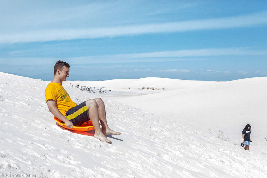
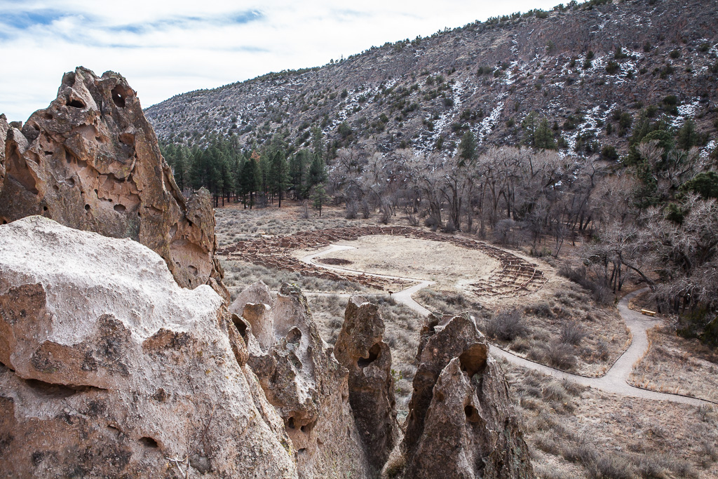
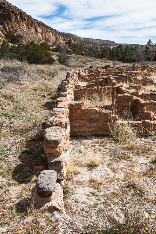
Sick of Winter?If you’re living on the U.S. East Coast right now, you may be sick of winter. While daytime highs make it up into the balmy 30s and 40s, your overnight lows plunge to the 20s. You’re looking at a near-record 104 inches of snow so far in Boston – it may end up being even more than last year’s record accumulation. Two Gorgeous Destinations For The Southwest’s Early SpringYet in the Desert Southwest, winter has given way to spring already – at least for now. We’ve seen daytime highs in the 60s and 70s, when they’re usually closer to the 40s and 50s. White Sands From A Collapsed Rock SoufléHow did we get a field of blinding white gypsum sands glinting in the sun over 275 square miles? It’s complicated. The gypsum – calcium sulfate – is a combination of the remains of marine creatures who decomposed into the bottom of a shallow sea 250 million years ago, and the salt ions in the water they lived in. That seabottom was uplifted into a giant dome 70 million years ago when the Rocky Mountains rose up out of the flatlands. The water rolled off the sides during the uplift, but slowly enough to allow the gypsum to evaporate out and stay behind, becoming sedimentary rock. Like a collapsing souflé, the dome slowly deflated into its center 10 million years ago. The cracked-apart rock turned into the world’s largest gypsum basin – White Sands. It’s Not Snow…I’d heard about White Sands for years, and finally made the drive south from Albuquerque. The Monument sits all by itself about 16 miles southwest of Alamagordo. As we walked the Alkali Flat Trail, I needed to remind myself it wasn’t snow I was looking at. For one thing, the ripples and shapes were all wrong, and constantly changing. The textures you saw in the morning might be totally different by the afternoon. For another, it was pleasantly warm – even though there were people sledding everywhere. Bandelier – Fire And AshBandelier’s story started with fire and volcanoes. Those seemingly-solid rock cliffs formed from solidified ash (tuff) after explosive eruptions. This isn’t surprising given the proximity of one of North America’s three super volcanoes, Valles Caldera, in the Jemez Mountains. Why It’s BandelierCochiti Pueblo’s Jose Montoya showed the area’s ruins to archaeologist Adolph Bandelier in 1880. Bandelier was so impressed that he dedicated the rest of his life to the study of Puebloan ruins and their archaeology. When the site was designated a National Monument in 1916, its name was chosen to honor Bandelier’s pioneering efforts to research Puebloan culture and preserve the site. Shot NotesI had to shoot with the sun high in the sky at both sites – my own fault for arriving late. Fortunately, sun angles are fairly low in late fall through early spring. And I had moving clouds at Bandelier, always good for diffusing sunlight and providing great sky textures. I featured important subjects and their details up close, then used shapes in the landscape to lead a viewer’s eye around the picture. I also chose shadows to give depth to subjects. When you’re faced with less-than-ideal light away from the Magic Hours, that’s one way to make it work. |
(408) 483-3782
Curious about how to shoot ruins?(408) 483-3782


Recent Comments