|
They Got Here First He threw seeds into the shallow pits he had dug. Chanting a prayer for abundant growth and good harvest, he carefully covered them and sprinkled precious water over the top. Then he turned towards the Turtle Mountain and thanked the gods for his life. 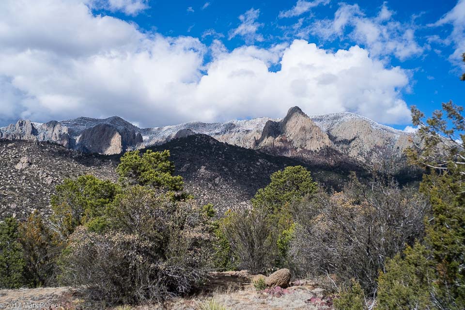 Sandia Mountains from the Pino Trail Pushing Up a Mountain They’re one of the tallest things in central New Mexico. About 25 million years ago or so, the Rio Grande Rift began pulling the land apart. To the east, the land resisted, and the Sandia Mountains plowed up as the rift valley sank in a classic horst-graben sequence. Human Use Several million years later, humans discovered the Rio Grande Valley and its abundant game and rich soil. Some smart early hunter-gatherer discovered he could throw seeds into the dirt and get things to grow. There was no need to migrate to new food sources. And presto! Archaic hunter-gatherers started living in one spot and became Ancestral Puebloans. Early Puebloans congregated near the northwestern end of the Sandias. They considered the mountain sacred, and it reminded them of a turtle’s shell. So they called it Turtle Mountain. Until 12 years ago, Sandia Pueblo claimed part of the northwest corner of the mountain. By a 2014 settlement, they’re permitted to use it for religous purposes while the federal government retains actual title. Pino Trail Many trails lace the Sandias on all sides. One of the best known is the Pino Trail, on the west side. 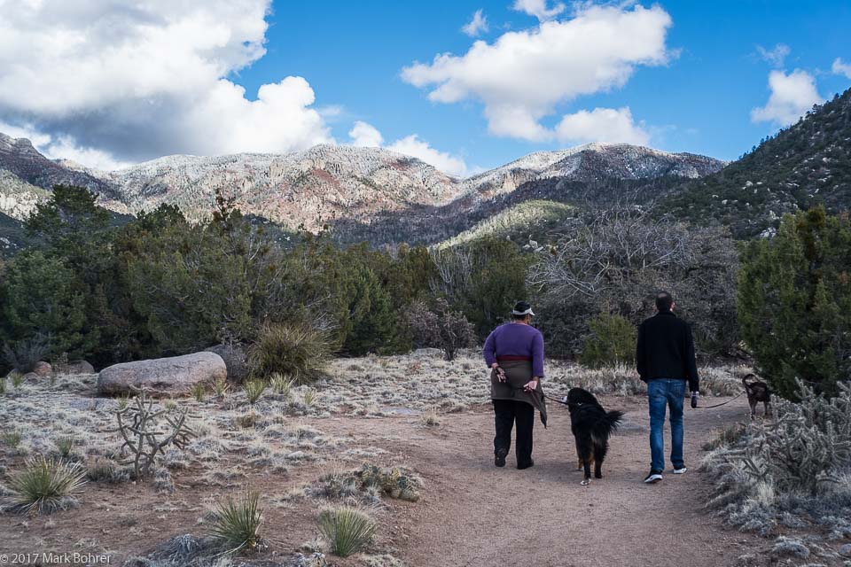 Walking the Pino Trail We started at the trailhead near Simms Park Road and Tramway Boulevard. The trail takes you up 2700 feet to a junction with the Crest Trail, eventually leading to the Sandia Tram to the north. Dogs are allowed, and we brought ours. It had rained the night before, and clouds were still rolling in. After a walk through desert scrub and alpine forest, tiny hail began to fall, so we turned around to head back. The dogs didn’t care – they got to chase new smells while their people worried about the weather. 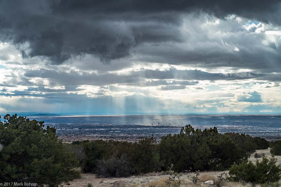 Godbeams and precipitation in the Rio Grande Valley In one of those just-in-time moments, the mixed hail and rain really started pelting down as we reached our cars. Shot Notes Shooting on the edge of an approaching storm can give you dramatic light. Cloud shadows pick out different mountain features and clouds make skies far more interesting. I’m pre-shrunk, so the only worry is my gear. Sometimes I get so-called Godbeams (crepuscular rays), in this case the streaks in the shot of the Rio Grande Valley from the trail. They appear when rays of sun light up air columns in cloud gaps or between solid objects like buildings. They’re naked-eye visible to begin with, but render best with a little contrast enhancement in Lightroom or Photoshop. I carried both mirrorless and dSLR cameras with cases for rain protection. The EOS 5D mk II dSLR and L-series 24-70mm f/2.8L zoom are both pretty well sealed, so rain wasn’t a worry there. But my mirrorless Fuji X-E2 and adapted Leica-mount lenses are not and would have needed the protection of a case in the rain. Clouds soften the light and decrease the contrast range, making it possible to shoot landscapes without special treatment. At times I had what Kodak used to call Cloudy Bright in their film datasheets, with very muted shadows. More Information Hikes in the Sandia Mountains, accessed from http://www.sandiahiking.com/trailguide.html Pino Trail, accessed from https://www.hikingproject.com/trail/7004908/pino-trail Pueblo Revolt of 1680, accessed from http://newmexiconomad.com/history/spirit/pueblorevolt.html Sandia Mountains, accessed from https://en.wikipedia.org/wiki/Sandia_Mountains#History Sandia Mountains land swap is nearly complete, accessed from https://www.abqjournal.com/408206/land-swap-nearly-done.html The Rio Grande Rift: Albuquerque Basin, accessed from http://academic.emporia.edu/aberjame/student/reardon3/RIFT%20NEW2.html |
(408) 483-3782
Curious about how to shoot ruins?(408) 483-3782

Recent Comments