|
I’ve always been fascinated by mountains and moving water. The first may seem easier to render than the second – mountains don’t move. But they’ve both been photographed to death, especially in Colorado. So how do you do it? Simple – find a really interesting piece of either one, and shoot to suggest the whole. Oh, and tell a good story while you’re at it. Easy, right? Flaming Gorge was a hard act to follow. Since the storms had cleared out, I didn’t expect Colorado to amaze us. But white-knuckle rides in an RV and an unusal rock feature made it interesting. 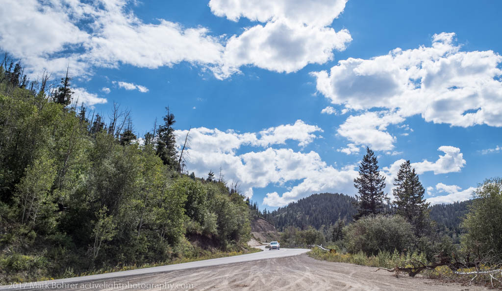 Ascending Colorado Highway 139… Twisted Highway On a map, there’s not a whole lot between Vernal, UT and Grand Junction, CO. Getting between the two is relatively quick. Just eyeballing it, I decided we should shoot for Montrose instead of stopping at Rangely or Grand Junction, both of which had forecast highs in the 90s. This was supposed to be the cooler way home, after all. What the map didn’t show was the twisty steep detail of Colorado Highway 139 at Douglas Pass Road. This was for sure a mildly Neil Peart-style road. Ranch buildings and cattle looked tiny in the valleys below us as we wound our way towards the pass. The final climb made it look like you’d drive over the edge into nothing. Once you crested the top though, you could see the tight right curve and the winding downhill that followed. We stopped a couple times for photographs where it was safe for a small RV. 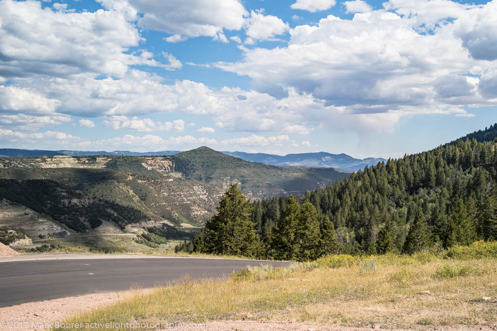 …And heading down from Douglas Pass, Colorado Highway 139 The road was easy after that. Mr. Peart probably would have been bored. Should Montrose be a No-Eat Zone? We got to Montrose in mid-afternoon, earlier than I expected – can’t trust a GPS or the arrival times it shows too much. We took the RV campground host’s recommendation of a local steak house. TripAdvisor reviews seemed to indicate dog-friendly outdoor seating, and when I called to make sure, they said, yes, they could accommodate us. When we got there, it was a different story – after again telling us we’d have to wait but they had a spot for us, the owner appeared and said no, they didn’t for us and our pups. Fortunately, we’d just walked the short distance to the place from the RV campground. So we looked up a brewpub within a couple miles, verified they could seat us with dogs, and went. This time, though, we waited for entrees that took forever. I guess they wanted me to drink more beer before the food arrived. 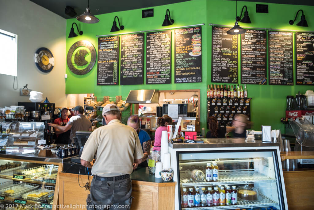 Backstreet Bagel, Montrose The town redeemed itself the next morning. The rolls and pastries at Backstreet Bagel & Deli were delicious, and packaged up for us without drama or delay. Heck, when they realized they’d given us a cinnamon roll we hadn’t ordered and left out another sweet roll, they ran down the street to catch us and just gave us the sweet roll. Then we got great service at Chow Down Pet Supplies where we went looking for the No-Hide Dog Chews both pups adore (and we know are safe to swallow). Everyone was helpful, including the resident cat. 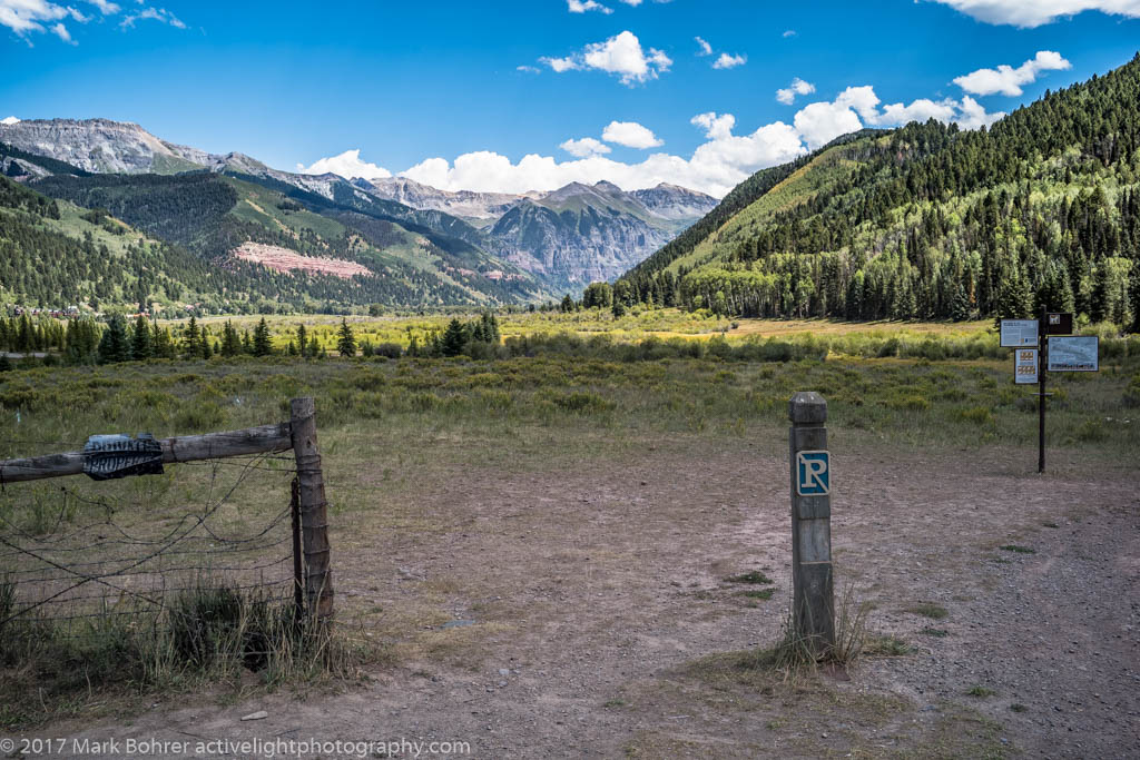 Signs of civilization near Telluride The Edge of the Rockies Colorado’s mountain scenery grabbed us after that. The mountains rise up to greet you south of Montrose, but only in a peripheral way. You’ll skirt the twisties and steep elevation changes using Colorado Highway 145. If you’re driving a motorcycle or sports car, you’ll have more fun on US 550. I’ve driven 550 from Ouray to Durango, and it requires absolute attention to the road. We’d taken much-easier Highway 145 between Ouray and Telluride once before, but we were enchanted all over again. 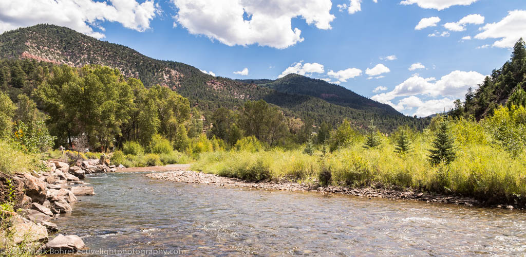 On the San Miguel River before Lizard Head Then it was on to Lizard Head. This extruded volcanic finger rises to 13,119 feet, and looks bizarrely different from the surrounding mountains. Before we got there, we paused a few times along the San Miguel River for compelling mountain views. With all the stops, it took a while to reach it. 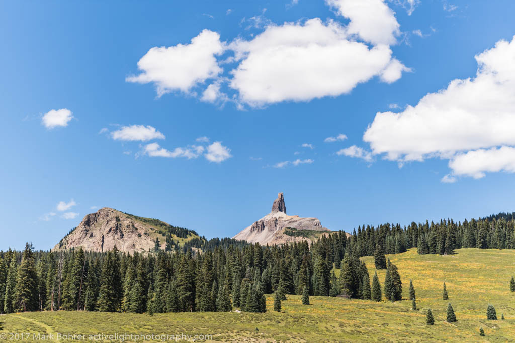 Lizard Head near the pass 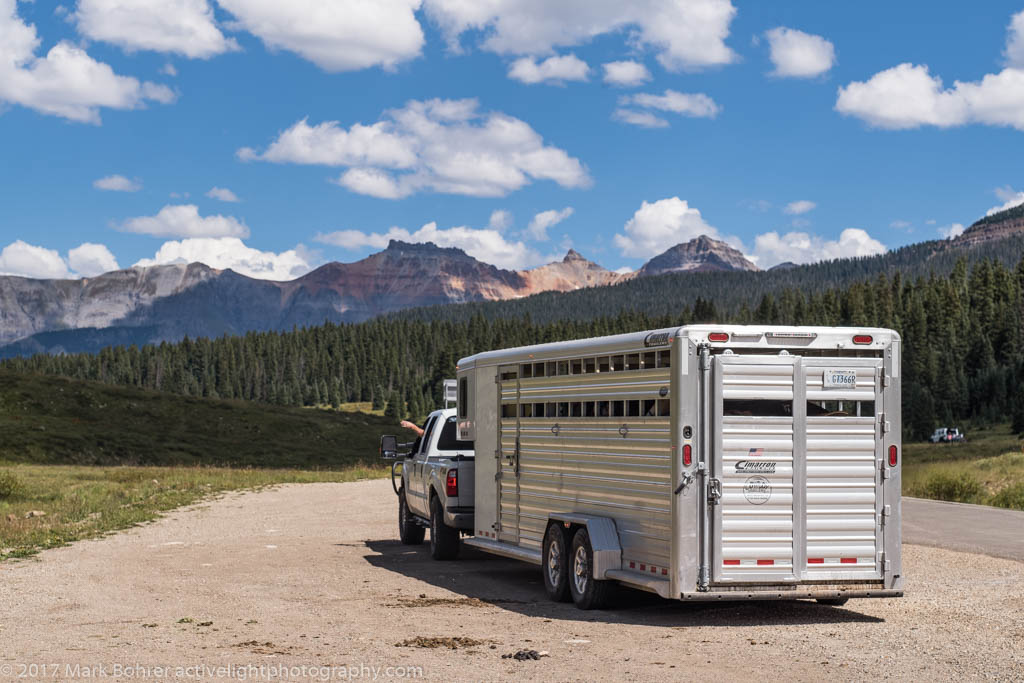 Horsepacker departure, Lizard Head Pass A horsepacker had stopped just over Lizard Head Pass to collect wranglers and horses. Wranglers have a tough job keeping horses healthy and clients happy. After checking the horses and tack, they loaded up and drove off. 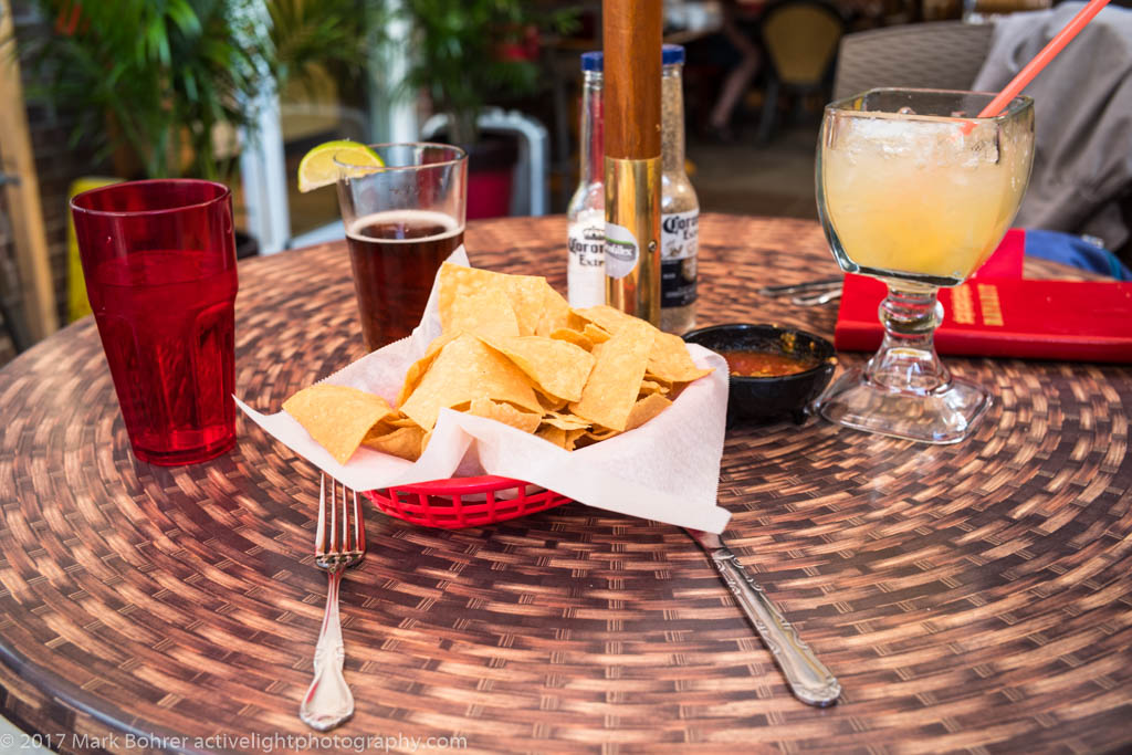 Chips and drinks at Nayarit, Durango We finally got to Durango, and had excellent Mexican dinner at Nayarit, on the north end of town. This place is one of our Durango go-tos. The salsa is just spicy enough to zing without being impossible to eat, the chips are fresh, the margaritas strong and tasty, and the carne adovada is flavorful and never too dry. Serve me a Negra Modelo and I’m set!  Durango near sunset Shot Notes I shot all the pictures with a Leica M10 and 28mm, 35mm, and 75mm lenses. The camera’s ISO was stuck at 200, so extremely low-light work was out. Leicas have always given bluish colors when set to auto white balance. But shooting raw, I didn’t really care since I would adjust white balance in Lightroom anyway. Lightroom’s Auto setting for WB is usually too yellow-greenishly warm, so I increased color temp a few hundred degrees from the camera’s choice to de-bluify pictures that needed it. However, light will be more bluish at high mountain elevations. That’s just the way it is, and something to keep in mind. The problem is the adaptive nature of human vision. We compensate for the color temperature our eyeballs see outdoors. When I see an image file onscreen, though, I see the color the camera captured. I try to remember the color I saw when I correct a shot’s white balance. I could shoot a calibrated grey card everywhere I go for absolutely correct white balance, but I’ve found it interferes with my shooting rhythm enough that the pictures aren’t quite as good. Colorado State Highway 139 (Douglas Pass Road), retrieved from http://tinyurl.com/yace5u26 Driving You Crazy: Douglas Pass along Colorado Highway 139 is crumbling beneath our tires! retrieved from http://tinyurl.com/y7fe5pev Backstreet Bagel Company, retrieved from backstreetbagelcompany.com/ San Juan skyway: hwy 145 or 550? retrieved from http://tinyurl.com/yczvq72f Lizard Head, retrieved from https://en.wikipedia.org/wiki/Lizard_Head Nayarit Mexican Casual Cuisine, retrieved from http://www.nayaritmexicandurango.com/menu.html This place will never look as empty as the website picture. Go as early as you can, and expect to wait. it’s worth it. |
(408) 483-3782
Curious about how to shoot ruins?(408) 483-3782

Recent Comments