|
The outdoors has a lot to offer in New Mexico, from striking million-year-old cinder cones to prehistoric 4-story buildings to snow-capped mountain peaks. So when California friends came to visit us, we decided to show them the sculpted slot canyons of Kasha-Katuwe Tent Rocks. Since it’s a National Monument, we figured it would be open every day except Christmas and U.S. Thanksgiving. 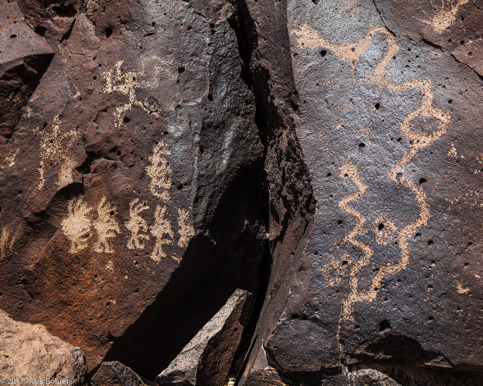 Kokopellis and snakes – La Cieneguilla Petroglyph Site But when we exited for gas before Cochiti Pueblo, a temporary highway sign informed us, “Tent Rocks closed 4/15 – 4/16.” Our first thought was that it had something to do with Easter. No one at the gas station knew why. We never did find out the real story. 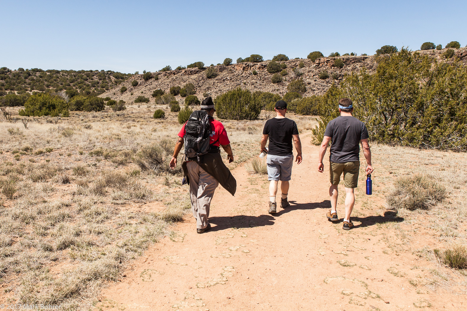 Walking in – La Cieneguilla So we took a quick plan B and headed a little further north to La Cieneguilla Petroglyph Site, just west of Santa Fe. There was just one other vehicle parked there when we arrived – this gem is always under-visited. 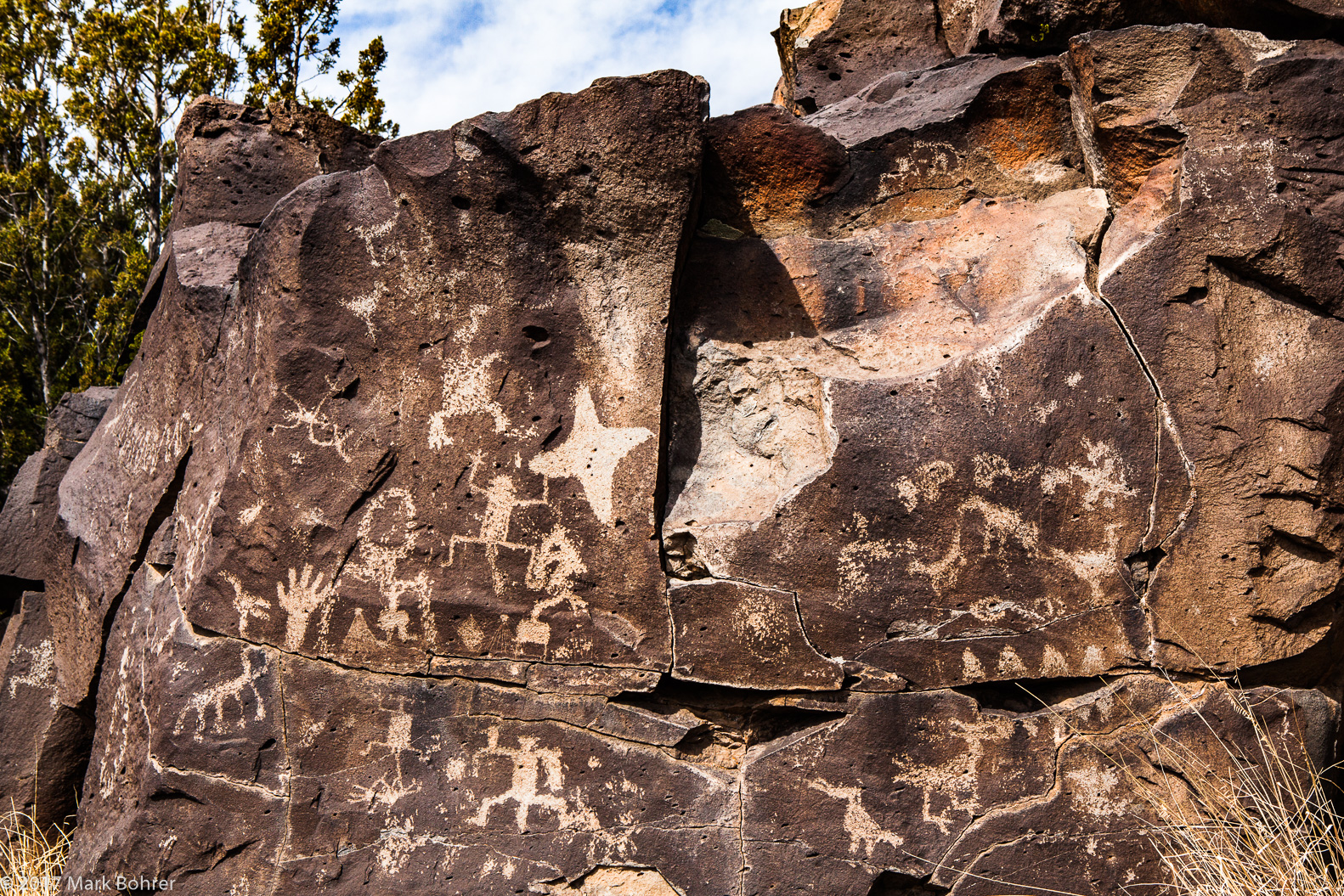 Toothy open-mouthed war god at center right – star kachina at center left Crumbled volcanic rock makes getting to petroglyphs a little tricky. But when you climb up, you’re rewarded with clan masks, thunderbirds, rows of Kokopellis, handprints, spiraled shield warriors – in pristine shape. That’s amazing, since they’re at least 700 years old. 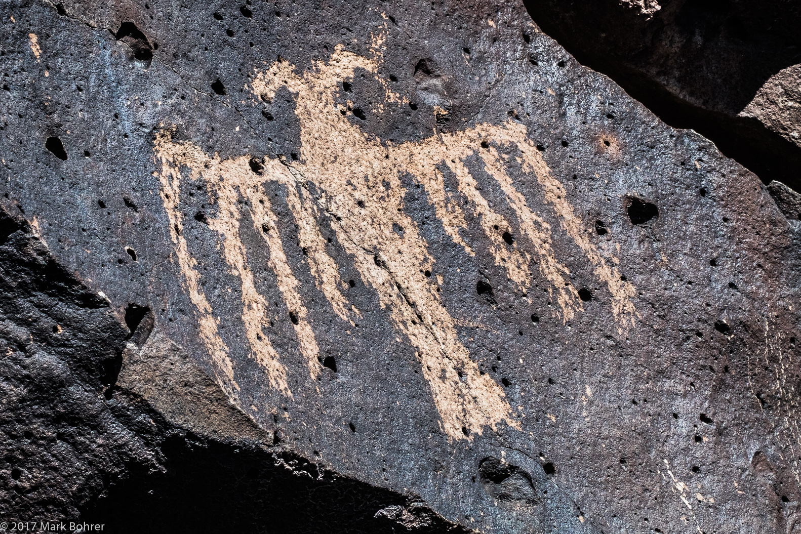 Thunderbird That upward scramble gains you at least 560 feet. You’ll find most of the petroglyphs towards the top of the mesa. It’s as if they had to be carved closer to the sky, where their ancestors were. 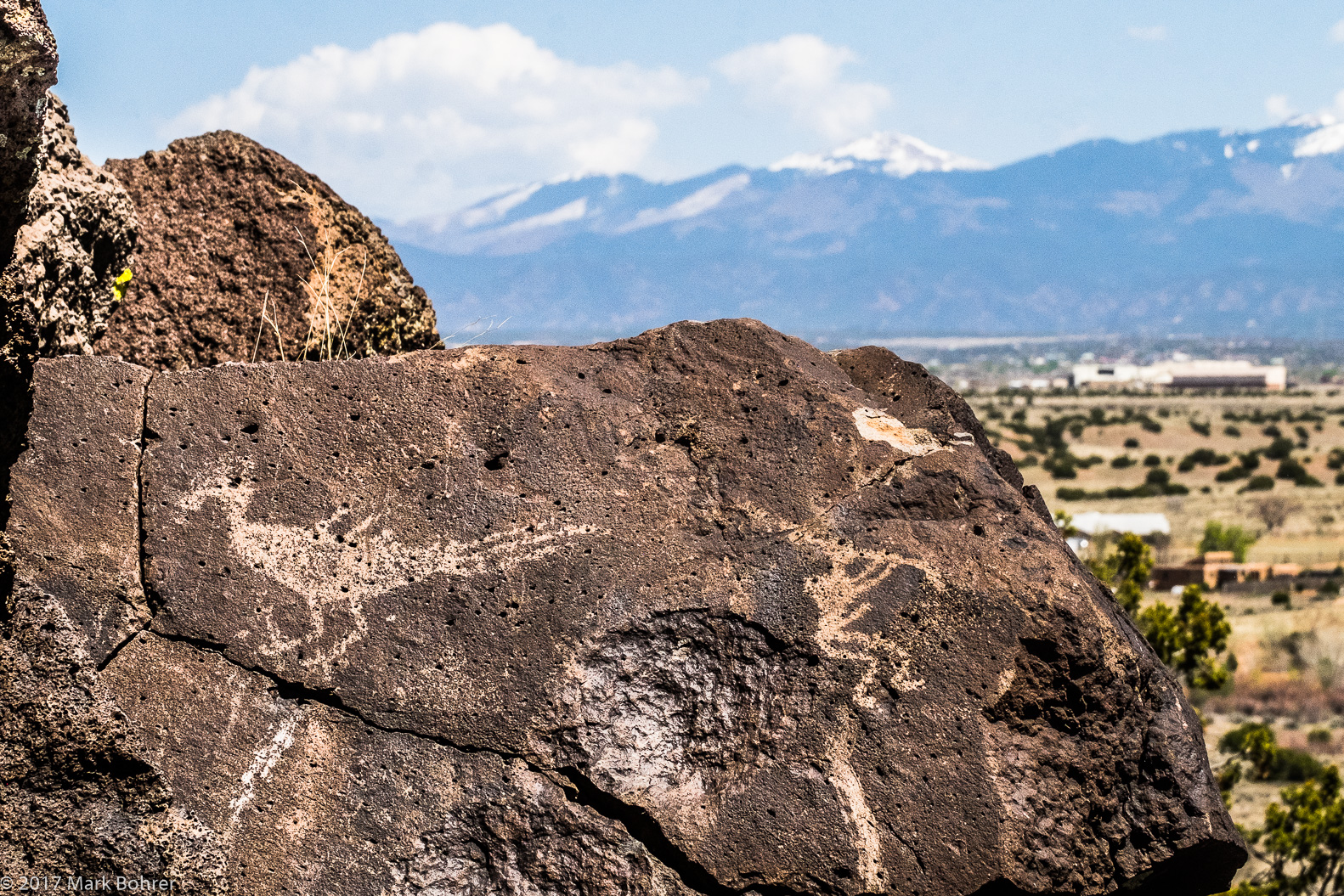 Sangre de Cristo Mountain backdrop We’ll never know what they were thinking of as they made them. They left no written language, only the cryptic carvings of – what? Gods to be worshipped, daily life, epic hunts, ceremonies? We’ll never know. Our friends appreciated the 1.25 mile hike. But as usual, I was much more excited by the history on the rocks than anyone else. I could almost see feather-robed priests carefully carving the flute-playing water sprinklers, praying for abundant crops on their creek-fed fields. 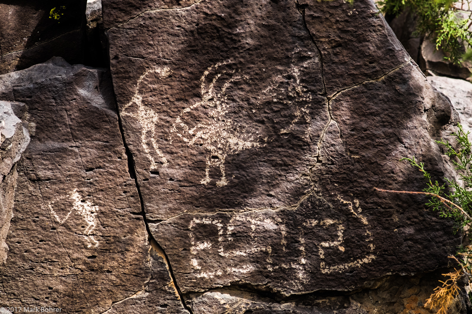 Kokopellis in the shade A 1000-room pueblo once stood on the banks of the creek near the mesa. It’s mostly gone now, but may have held a hundred-plus farming families. More Information Near the End of the Long Journey on the Camino Real, accessed from http://greenfiretimes.com/2015/07/near-the-end-of-the-long-journey-on-the-camino-real/ La Cieneguilla Pueblo (LA 16), accessed from http://galisteo.nmarchaeology.org/sites/la-cieneguilla-la-16.html Directions to the trailhead – From Albuquerque, take I25 north to NM 599, then turn left at Airport Road. |
(408) 483-3782
Curious about how to shoot ruins?(408) 483-3782

Recent Comments