|
Like it or not, you depend on the weather. All of us are pre-shrunk, and with the proper clothing, weather isn’t a problem. But you’d like to know what to expect before you go, especially any interesting light or sky conditions for photography. Fortunately, answers are as close as your smartphone. 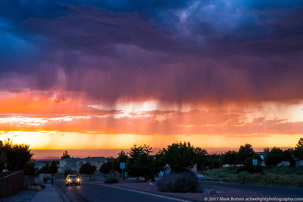 Approaching storm, Albuquerque Yes, Apple and various Android phones provide built-in weather apps. But they don’t give you much beyond high and low temps for the next five days, when you might see rain, snow or wind, and maybe barometric pressure. What about the actual area getting rained on? And is there a front moving in or out? There are several apps to help you plan for conditions before (and during) your next photo shoot. These are the ones I use regularly. And yes, I am an iOS user – iPhone and iPad – so my app selection is biased that way. Living Earth Never underestimate appearance and the user interface (UI). Living Earth is very pretty – you get an animation of clouds, snow/ice coverage, and the day/night terminator as it moves across the globe. The view centers on your selected location, and gives you current temperature, the day’s high and low, and an icon for weather conditions at that location. Tap on any day’s weather, and a list of hourly weather predictions appear underneath. 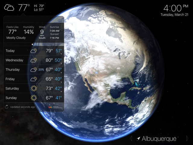 Living Earth You can also search for other locations in the app, save them, and choose any for display from your list. I’ve had as many as 12 places saved, and I don’t think there’s a limit to how many you can have. When I travel, I set the app to use my current location for current conditions wherever I happen to be. Its weather data come from Weather Underground, so it’s reasonably accurate. Besides the cloud animation, you can also display color-coded temperature, wind and humidity across the globe. I never use it, but there’s also an alarm clock in the app. Living Earth shows predicted conditions for the next ten days – something most other apps won’t do. Of course, the farther out you go, the less accurate they’ll be, but you’ll get some idea of what’s coming. The app will also display a two-digit local temperature on its icon, so you can see how cold or warm it is at a glance, without tapping anything. But when I want to see the extent of a storm, I need something more. MyRadar MyRadar shows you precipitation for the previous 60, 90 or 120 minute period at 5 or 10 minute intervals, overlaid on a traditional road map or a satellite terrain map. The maps are so good I’ve used them to identify features I’m driving past (as the passenger, of course). You get five-day and hourly forecasts, plus National Weather Service warnings and alerts with the affected areas displayed on the map. You can also set it up to display earthquake severity and locations on the map over the past hour, day, week or month, which might be important for traveling in California, or through Oklahoma or Texas. 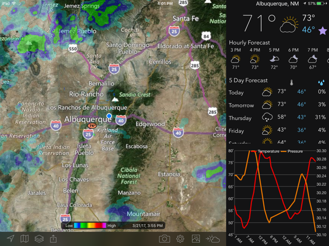 MyRadar MyRadar offers Sigmets, Airmets and other weather information important to pilots. It also displays hurricanes and tropical storms with their predicted tracks. And the map colors are great – rain is really easy to see in blue, green, yellow, and red, depending on intensity. Snow shows up in shades of grey. And you can choose the opacity – how much of the map is blanked out by the radar trace. It’s available for Android and Windows, in addition to iOS. But its weather information has been less accurate than Living Earth’s. If you live outside Canada and the U.S., it won’t help you. And it doesn’t offer any future radar track for precipation. For that, you need the next app. Storm Storm will give you future radar forecasts. It uses several sites from your target area for wide-ranging radar predictions. You have youir choice of five hour and one hour future storm radar. For five hour, it’s in 15 minute increments, and in one-minute increments for one hour. And you can choose multi-site past radar or past data from a single site. This app gives you 10 days of predictions, not surprising since its data also comes from Weather Underground. 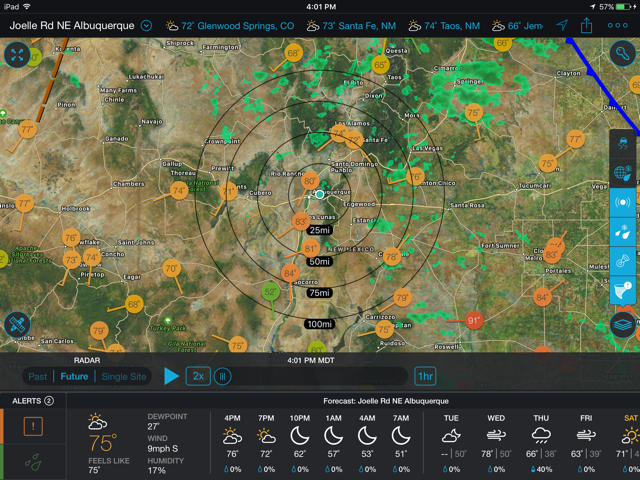 Storm – future radar view It graphs temperature, humidity, barometric pressure, rain and snow accumulations, UV index, and windspeed. This shows you trends that help in predicting what happens next. For example, if the barometer is dropping, that could mean a storm is coming. I was at Taos Pueblo one afternoon when I noticed it suddenly getting really cold. So I went inside one of the Pueblo’s shops to warm up. As I walked in the door, heavy snow started behind me. Storm’s temperature trend info can help predict this sort of thing. Storm’s radar colors are a bit harder to read, and its maps aren’t quite as good as MyRadar. Still, its future radar display and accuracy earn it a place on my mobile devices. Special Teams There are a couple more apps I use in special situations. If I want a quick and dirty prediction for rain in the next hour, I’ll open Dark Sky. This one guesses at rain and snow levels for the next 60 minutes. It also shows basic weather predictions for the next 7 days, and sunset time. The vertical display of humidity over the next 20 hours is interesting – you can see how much you’ll drip just standing still in Illinois or Florida. And wind speed predictions can be important in the Southwest, where you can get vertical walls of blowing sand as scary as any good disaster movie. I don’t use it, but Dark Sky’s global radar display is interesting. 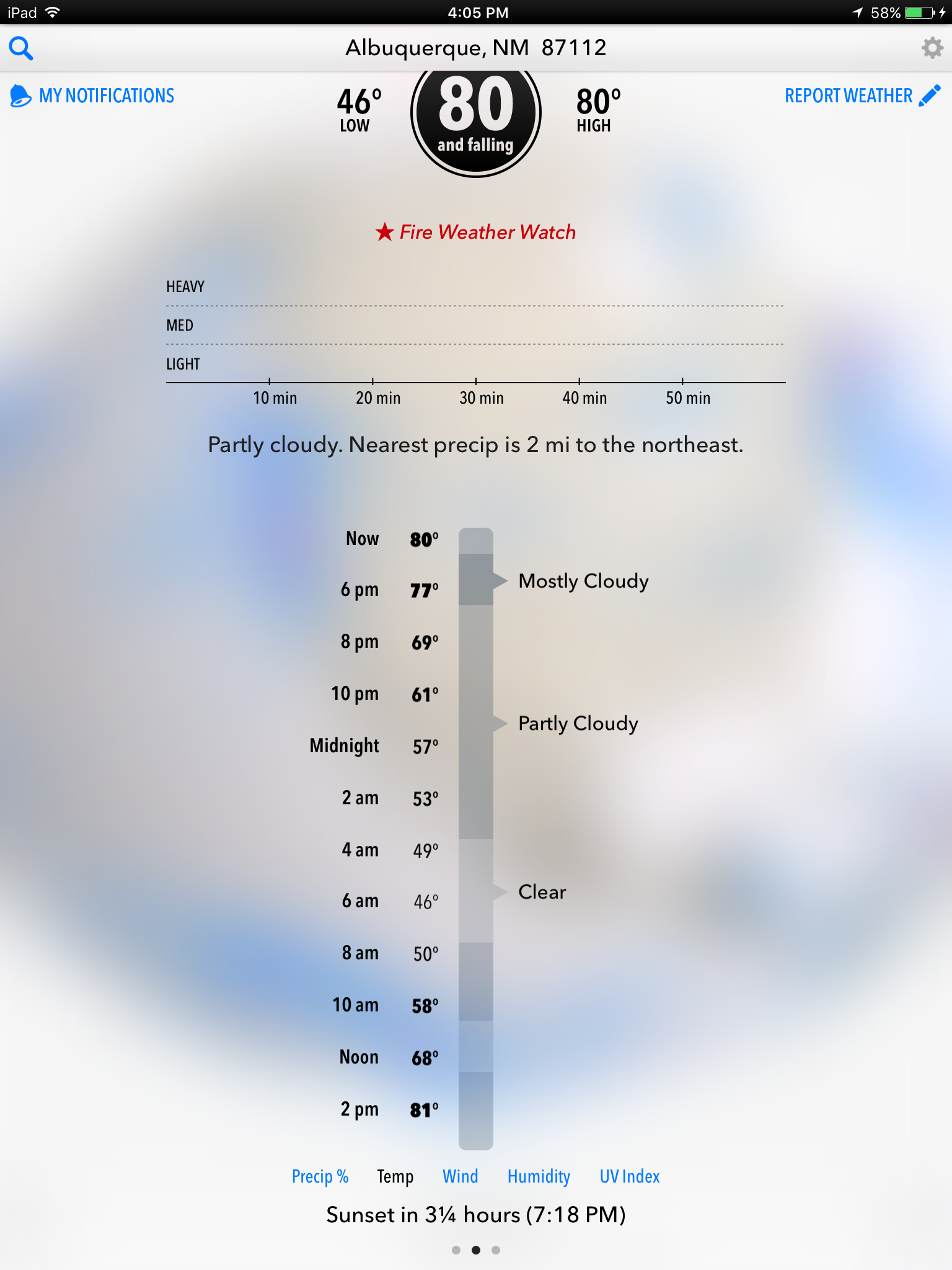 Dark Sky – rain prediction for the next hour Fire seasons are getting longer. US Fires will map major wildfires and give you their containment status every day. This helps when I want to avoid smoke and hazardous areas for shooting or travel. 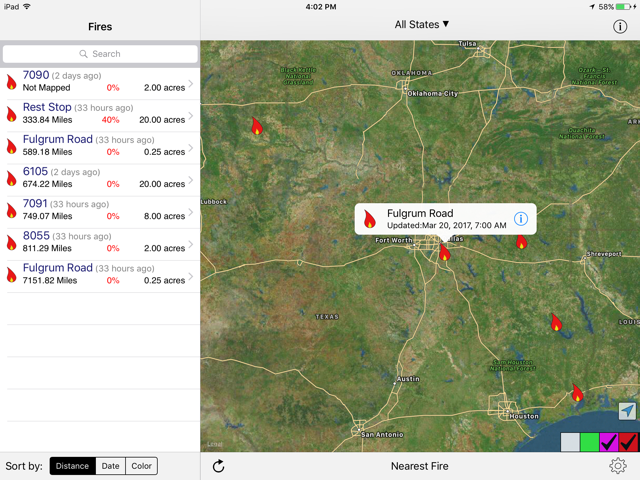 U.S. Fires – wildfire mapping Finally, Full Moon gives me a very pretty lunar calendar, plus moon rise and set times for any location I choose. I can also check future moon phases. 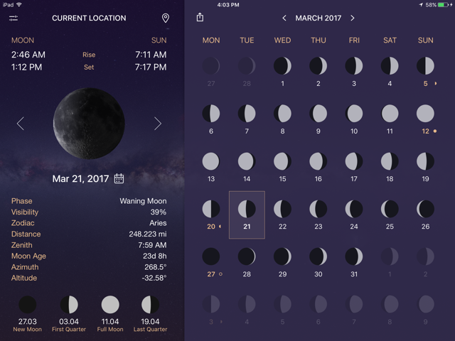 Moon Phase – lunar calendar My dSLRs and lenses while a few years old are reasonably well weather-sealed. I never worry about using any L-series Canon lens on a prosumer EOS dSLR in the rain. Leica M-mount lenses and mirrorless camera bodies are another story. I pay close attention to weather and bring cases for them if there’s a chance of rain or wind-driven sand. And I watch the forecast and storm tracks religiously. In any case, I much prefer stormy skies to boring blue backgrounds. 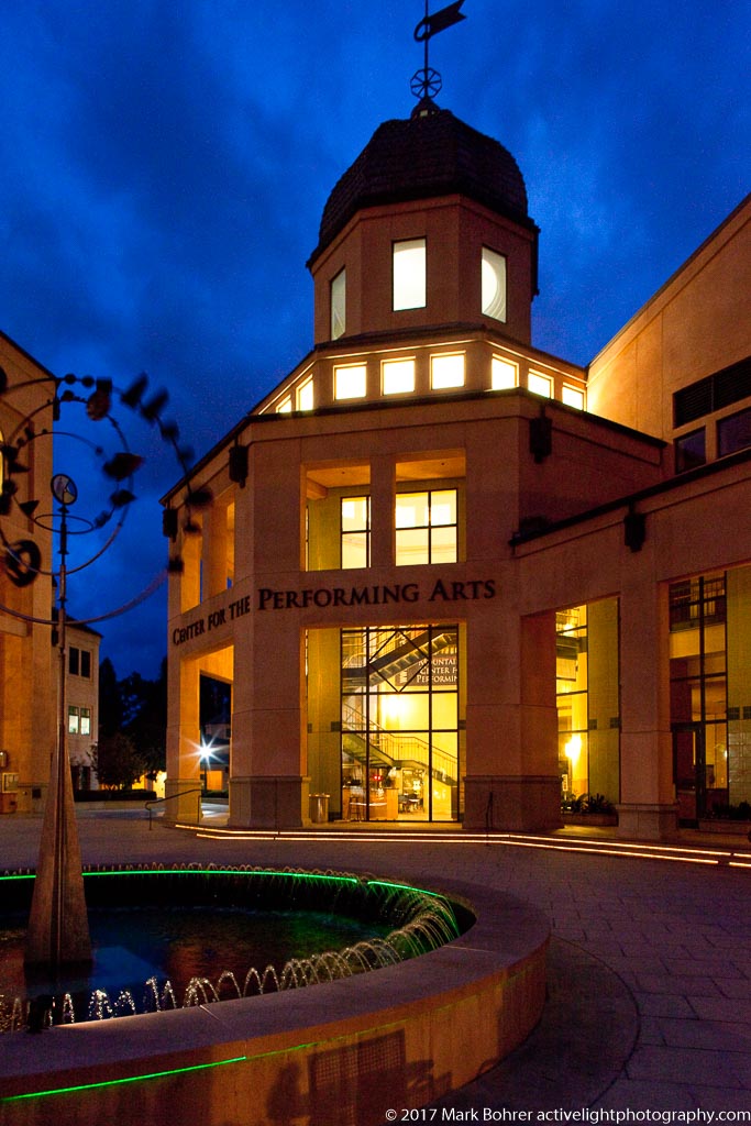 Mountain View Center for the Performing Arts, California Northern California gives you boring clear skies from May through October. So when the first big fall storm was predicted, I tracked it and took advantage of dramatic clouds over Mountain View’s Center for the Performing Arts. I used a remote-triggered flash to light up the water at lower left, and a 24mm f/3.5L TS-E lens shifted upward to get the whole building in without tilting perspective. |
(408) 483-3782
Curious about how to shoot ruins?(408) 483-3782
Recent Comments