|
Work time’s over. You’re looking for a way out of the city, or just want to head out for a couple days. So you pack up, fill the tank, and do… what? Go where? Any choice is tied to a story. What story do you want to experience – to tell your friends, your family, your viewers? Once you make that choice, how do you share what you saw and felt? Here’s how I grab my viewers – and keep myself intensely interested. 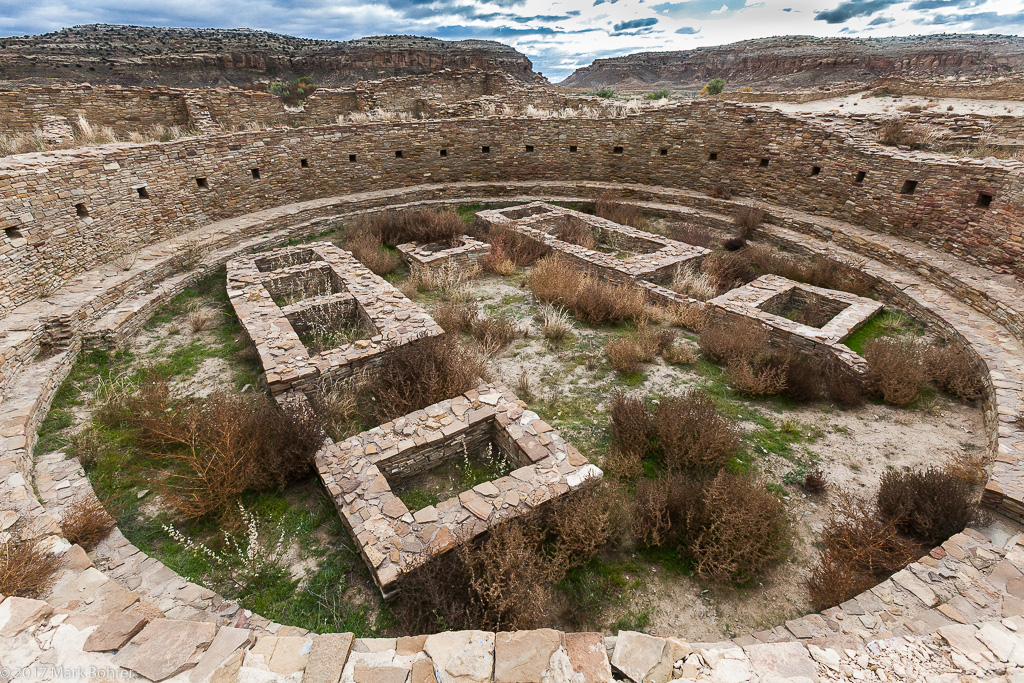 Great Kiva, Pueblo Bonito, Chaco Canyon You’d Better Be Passionate You need to really care about your story. I wanted to see New Mexico’s clear light and intense color after reading about Ansel Adams photography and Georgia O’Keefe ‘s painting out there. Then I stumbled into 1200 years of Pueblo culture in a hostile place where no one should be. 13 multi-story Great Houses built by hand – no tools, no wheel, no horses – in the center of marginal water and wildlife. Then leaving everything they’d built and walking many miles north for reliable water, more Great House construction, and violence not reported by last century’s archaeological establishment. Eventually, a complete move out to other pueblos hundreds of miles away – abandonment. 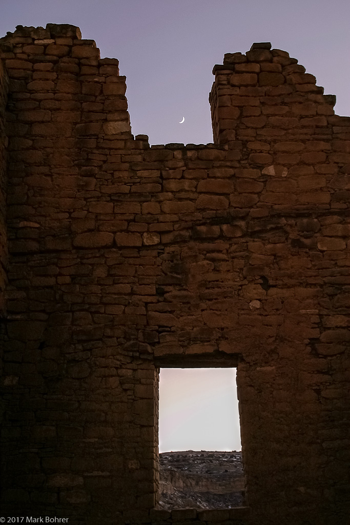 Kin Kletso and moon, Chaco Canyon You’d Better Be Curious And I was curious – what brought them there? Why did they build? What did they eat? How did they keep warm in winter and cool in summer? How did they survive for so long? Why did they leave? And where did they go? Capture the Emptiness The remoteness is the first thing that hits you. You see abandoned trading posts, convenience stores and Navajo hogans, a few pumps sucking oil out of land planted in weeds, and pickups with tool boxes and flags. A sign directs you off the highway and down the paved road to Chaco Canyon. 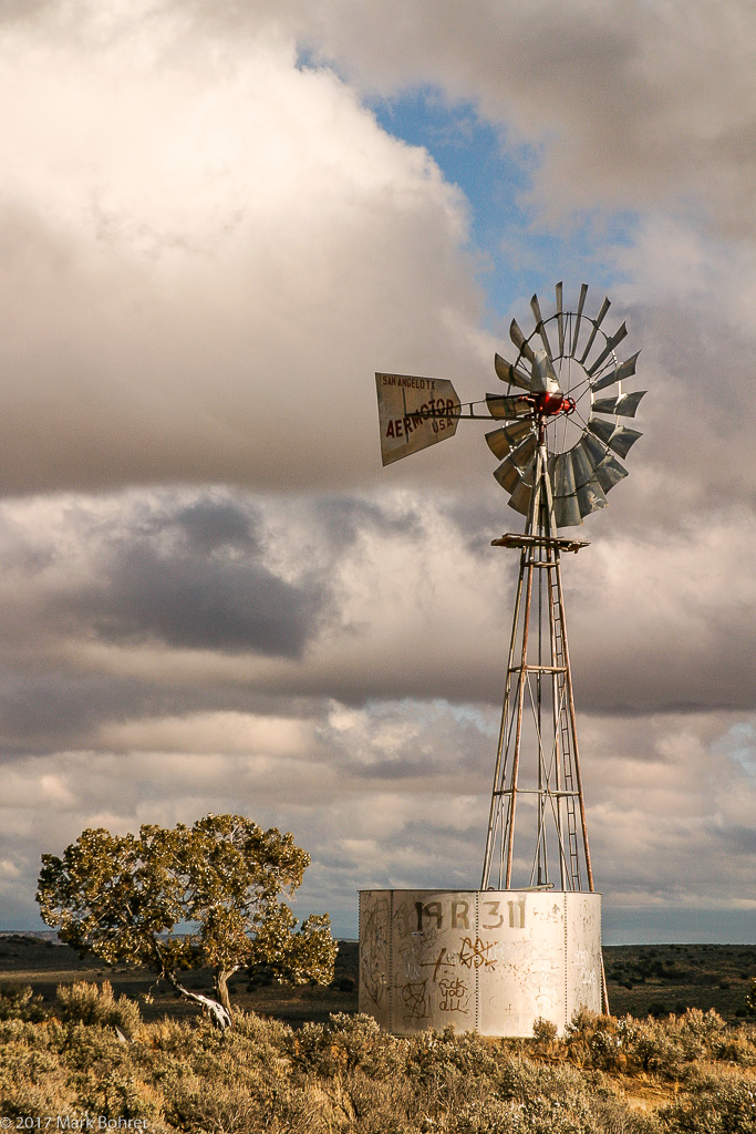 Windmill on the road to Chaco Canyon When the pavement becomes rough dirt winding through nothing but desert scrub, you ask, why would anyone come here? And that’s the start of your story. I use wide establishing shots to capture that question in the emptiness of the land. 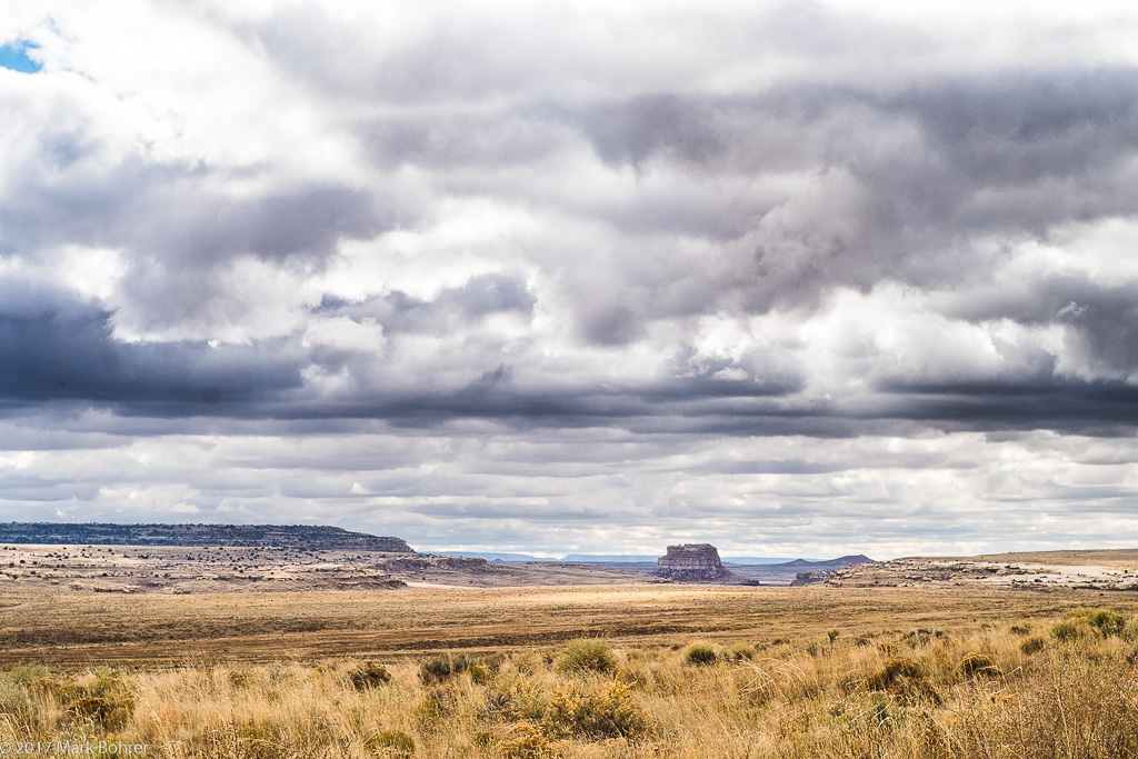 Fajada Butte landscape On your way in, you’ll see Navajo hogans, and windmills to yank up limited water for sheep, dogs and their people. These are all part of the modern story, and closer wide shots focus viewer attention. A stone thumb peeks at you around those slow, bumpy turns. As you make the final turn and cross back onto Park Service pavement with a sigh of relief, that thumb becomes a huge banded hulk. Inside Fajada Butte are deliberately-placed 2-ton sandstone slabs whose shadows make the Sun Dagger across pecked petroglyph patterns. The Sun Dagger likely started as a seasonal timer for planting and harvest, but probably evolved into a ceremonial marker. 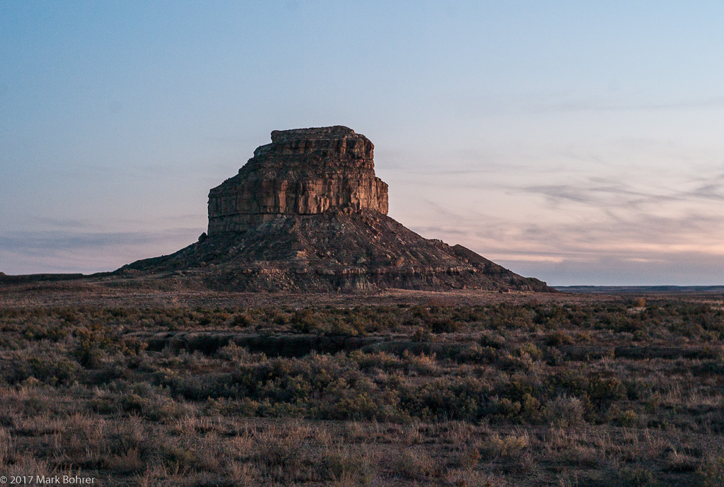 Fajada Butte The huge slabs lean like a delicate house of cards. Because of their recent shifting, you’re not allowed to climb up and see the Sun Dagger anymore. But wide landscape shots during daytime and at night show size and clear skies as Ancestral Puebloans saw them. 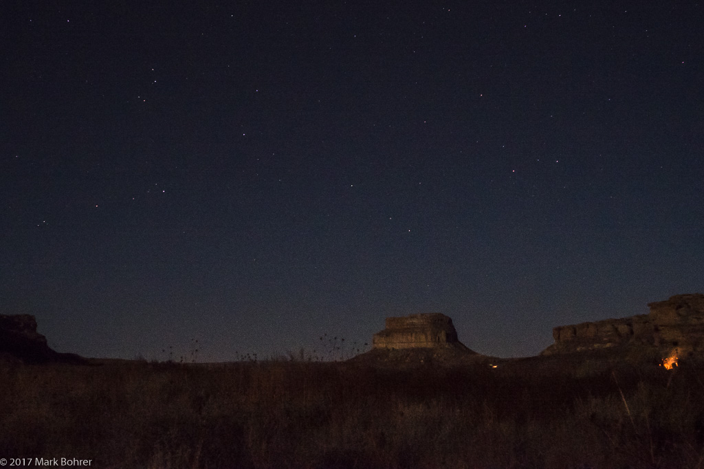 Fajada Butte and night sky from Gallo Campground, Chaco Canyon Was Fajada Butte a first beacon for Pueblo travelers, a marker for the canyon’s eastern mouth? It’s the most prominently obvious form in the Canyon, day or night. The pavement leads past Una Vida ruin on your right, and a dry riverbed on your left. Chaco Wash is empty unless there was a recent storm. I’ve only seen water in it during winter. But Chaco Canyon was wetter in the first millennium CE, and the Wash’s water may have helped bring people there. It’s another part of the story. A low angle shot makes the absence of water intensely clear. 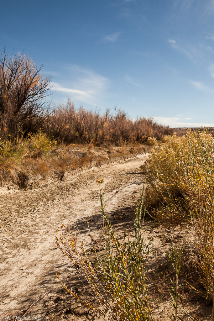 Dry Chaco Wash on the way to Penasco Blanco Ruler-Straight Impact In Near-Far Shot After you pay your respects and a few dollars to the modern National Park Service presence, larger Hungo Pavi appears, then much-larger Chetro Ketl with its ruined colonade, and classic D-shaped Pueblo Bonito. The first thing you notice are amazingly-straight front walls. Wait, isn’t that wall like an arrow pointing west? Turns out Pueblo Bonito’s front wall is within 0.13 degrees of true east-west. Why are Bonito and Pueblo Alto high above it precisely aligned to 0 and 90 degrees, while next-door neighbors Chetro Ketl and Kin Kletso line up with moonrise positions at lunar “standstills” every 18.6 years – about +/- 67.1 degrees? A deep focus near-far shot down that wall towards the sun highlights its ruler-straightness. 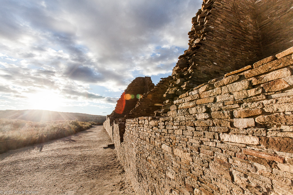 Pueblo Bonito south wall – aligned E-W within 1 degree Was the building alignment another expression of power over the environment? That’s another part of the story. Figures in a Huge Landscape There’s a trail up the crack behind Kin Kletso, and over to Pueblo Alto and Pueblo New Alto. A wide shot with a small figure climbing shows the size. 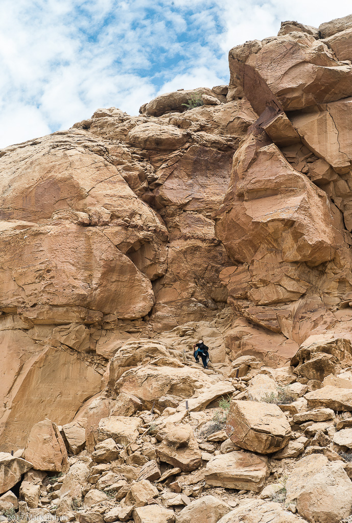 Pueblo Alto / North Mesa trail – climbing behind Kin Kletso From up there on North Mesa, you can make out lines of sight to Huerfano Mesa and beyond. There used to be a wide, paved road starting from Pueblo Alto, but today you need the sign to find it. It ran north almost to Aztec, the later Great House community 42 miles away. Why did people without horses or wagons build a paved road and smaller outlier pueblos along it? 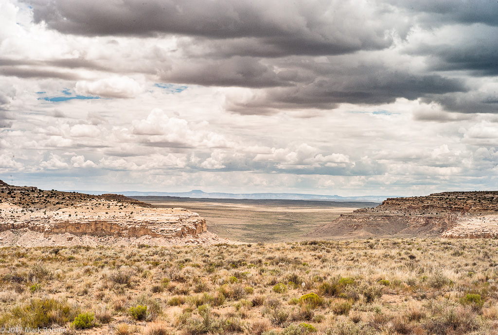 Looking north from Chaco Canyon to Huerfano Mesa The distant central knob is Huerfano, and the distant roads are all modern Winter Snow – Burned Walls and Charred Beams Pueblo Bonito hosts several round rooms, closely resembling the kivas of modern pueblos. Bonito’s biggest round room shows burns on the walls, a mark of ritual abandonment in modern Pueblos. That’s a final (but not the last) question – why did they leave, after 400 years of building over 2000-plus square miles? Another wide shot shows the burned kiva wall, and a winter shot emphasizes the abandonment. 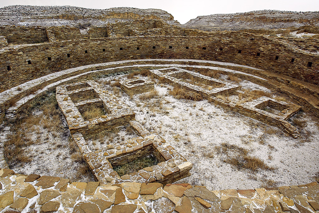 Great Kiva, Pueblo Bonito, Chaco Canyon – clearly-burned walls at right rear Farther north at Salmon Ruin, there are charred roof supports from the incineration of a tower kiva. This one isn’t abandonment – it’s mute evidence of a raid that left several torn-apart human skeletons behind. 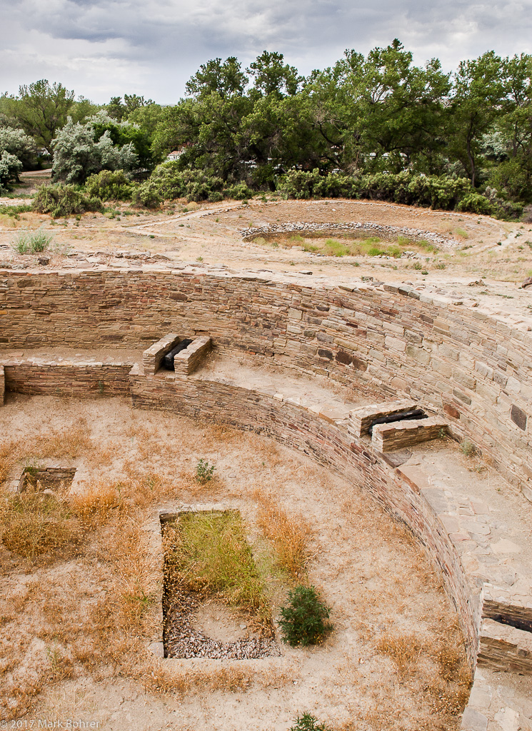 Charred roof supports, tower kiva, Salmon Ruin Sharing the Experience All these questions pump me to shoot the human and natural features, and make viewers wonder about them too. The time, weather and viewpoints you choose guide the narrative – dry, scrubby landscapes, windmills and dry washes without water, stark human construction in remote, isolated areas, basalt-topped mesas with background cinder cones. Ruined buildings speak of long abandonment. A remote flash placed inside a ruin wall makes it look as it might have when people lived there. It can also mimic the firelight of daily life 800 years ago. I feel the loneliness, especially in winter shooting, but lighted ruins also recall the activities of people who once lived here. 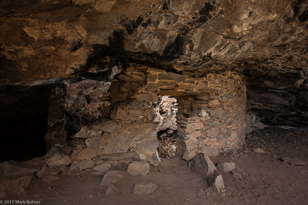 Lower Scorpion ruin, Gila Cliff Dwellings, as it might have looked to residents The story’s in pictures that make people think. But don’t write about shots you didn’t take. That’s where shooting multiple views comes in. It helps to have rough story ideas in your head to start with – they’ll direct your shooting. But leave yourself open for unexpected stuff – spontaneity can be cool too. 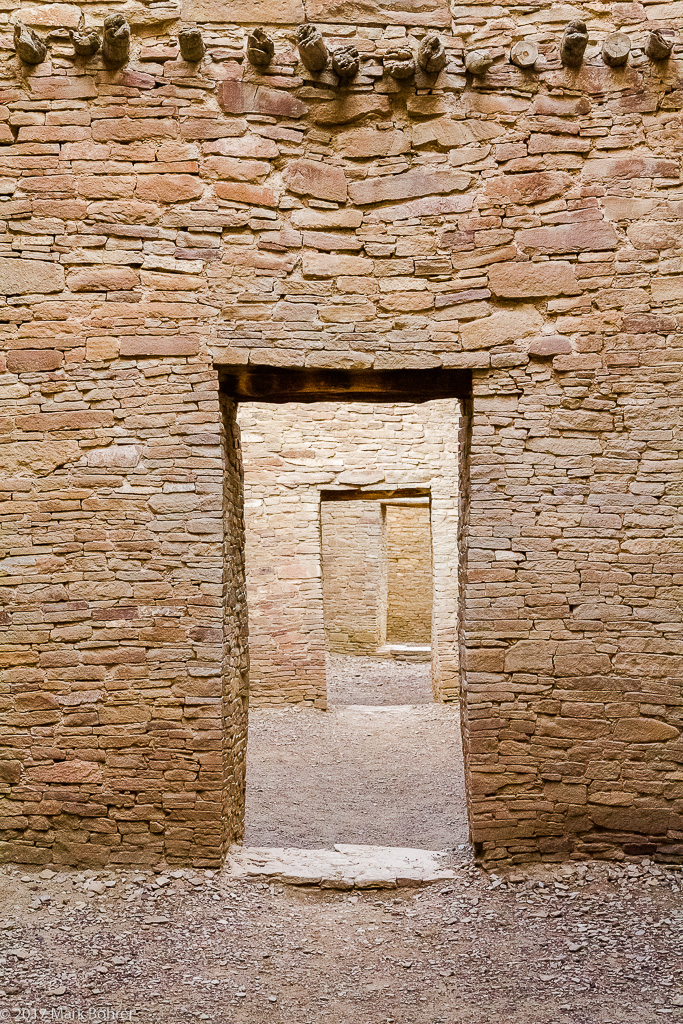 Empty doorways, Pueblo Bonito, Chaco Canyon Why did they leave? The short answer – prolonged drought, overhunting, played-out soil, bad crops, and fighting over what was left. But they left no written language, so we can only guess what happened from the traces and artifacts. More Info Fajada Butte Home of the Sun Dagger accessed from http://www.angelfire.com/indie/anna_jones1/fajada_butte.html Anna Sofaer, The Primary Architecture of the Chacoan Culture: A Cosmological Expression, accessed from www.solsticeproject.org/primarch.htm Film Studies 101: The 30 Camera Shots Every Film Fan Needs To Know accessed from http://www.empireonline.com/movies/features/film-studies-101-camera-shots-styles Mark Bohrer, Tracking the Anasazi: How Great Houses Led to Stripped Resources and Abandonment, accessed from activelightphotography.com (scroll down) |
(408) 483-3782
Curious about how to shoot ruins?(408) 483-3782
Recent Comments